


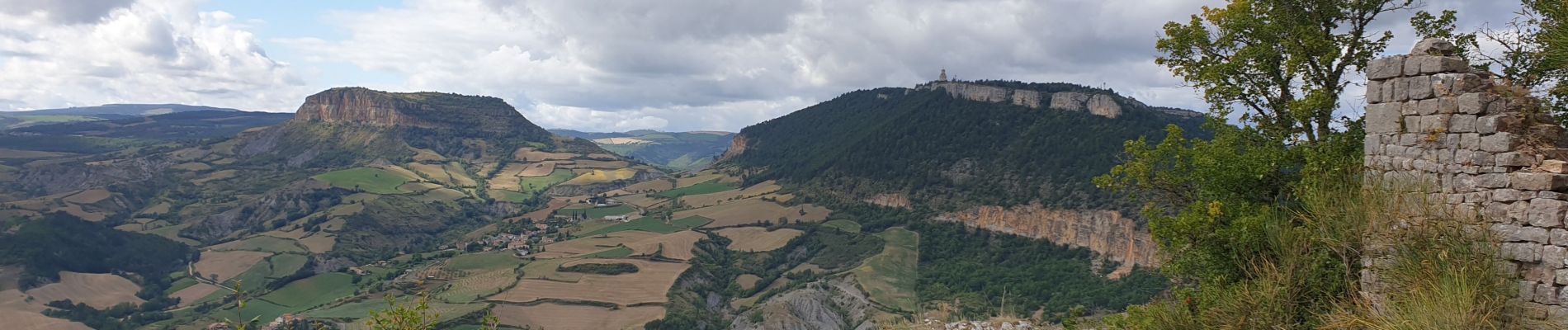
la cresse, belvédère de caylus

francislassauce
User
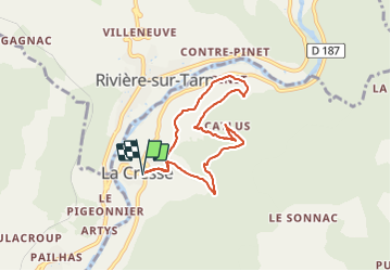

Length
6.9 km

Max alt
684 m

Uphill gradient
326 m
Km-Effort
11.3 km

Min alt
398 m

Downhill gradient
324 m
Boucle
Yes
Creation date :
2021-08-16 13:55:21.885
Updated on :
2021-08-16 17:08:32.442
3h12
Difficulty : Medium
1h00
Difficulty : Difficult

FREE GPS app for hiking
 SityTrail
IGN / Geographical institutes
SityTrail Plus
The world is yours!
About
Trail Walking of 6.9 km to be discovered at Occitania, Aveyron, La Cresse. This trail is proposed by francislassauce.
Description
très belle promenade.
voir photos.
Photos


Positioning
Country:
France
Region :
Occitania
Department/Province :
Aveyron
Municipality :
La Cresse
Location:
Unknown
Start:(Dec)
Start:(UTM)
510429 ; 4891598 (31T) N.
Comments